Map Snapshot
June 30, 2026
Side-by-Side Comparison
Interactive Map (GPS Data)
Edited Trail Map (v2)
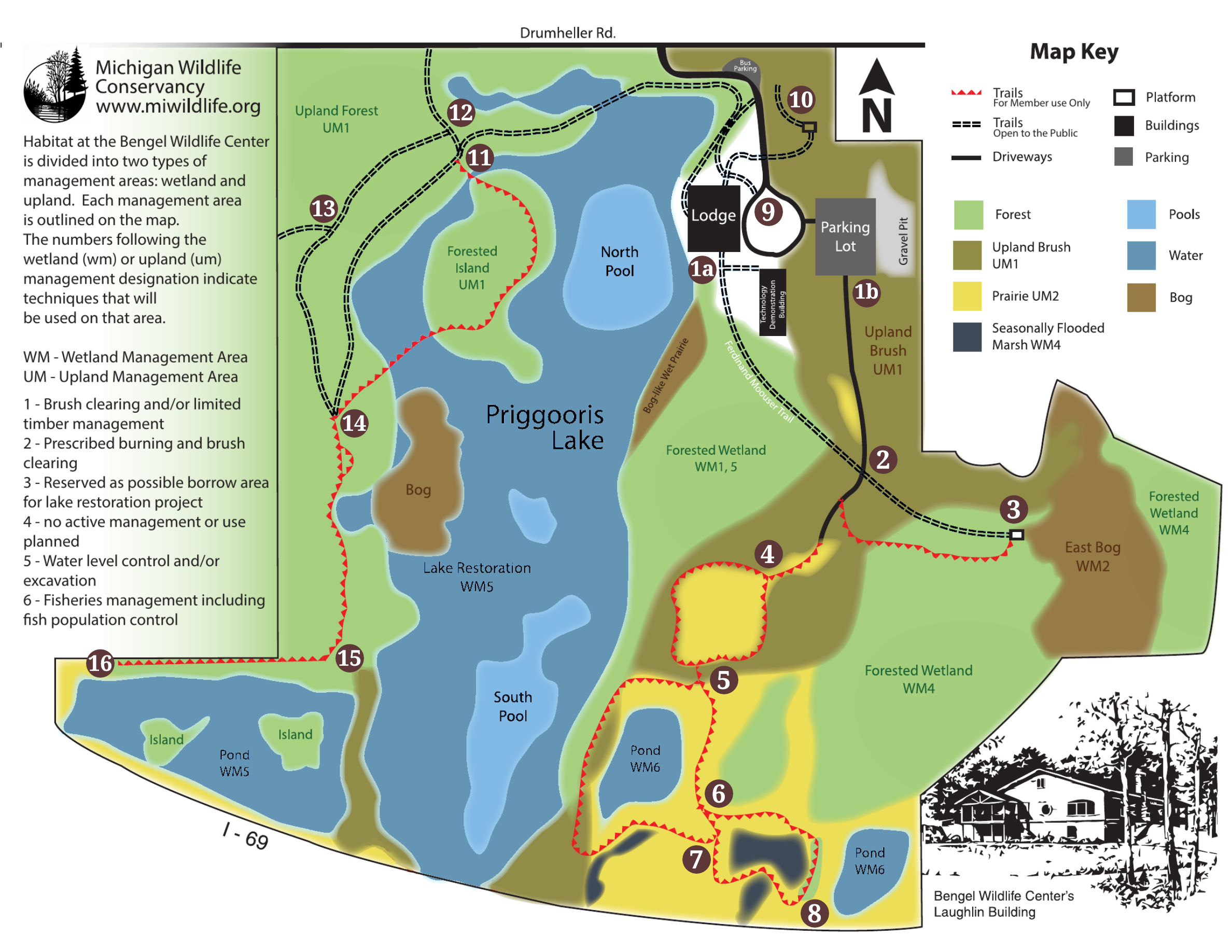
Identified Issues
POI #13 / #14 mismatch
POI #13 on the edited map appears to correspond to GPS waypoint #14. Needs verification on next site visit.
POI #15 placement
GPS waypoint #15 is positioned too far north. It should be at the top of the loop and likely represents #14. The actual #15 location (at the southern bend) was not reached during collection.